Tuesday, October 15, 2019

Mineral King 10/12/19 - 10/13/19

With the daylight winding down, and the temperatures starting to drop, I figured I should get out and do one last big run before the season really comes to a close. Gotta take advantage of the shape I'm currently in and explore! Well, in this case, it was more complete a loop I tried unsuccessfully to do with my sister almost exactly 3 years prior (with a day two bonus!).

The weekend routes:


Day 1:

The big day one loop is a 46km loop with around 3000m of climbing over 3 passes. The three passes in the clockwise direction I did the run are: Timber Gap, Black Rock Pass, and Sawtooth Pass. I ran this loop clockwise because I thought it would be significantly easier to come down the steep, un-maintained trail from Sawtooth Pass than to go up it (hint: it was). I started the day around 730am, a little after sunrise.


Looking down into Mineral King Valley and the peaks to the south.


Timber Gap


Some pointy rocks near where Timber Gap Trail and Black Rock Pass Trail intersect


Cliff Creek Valley (Black Rock Pass Trail)


Fall colours while approaching Pinto Lake


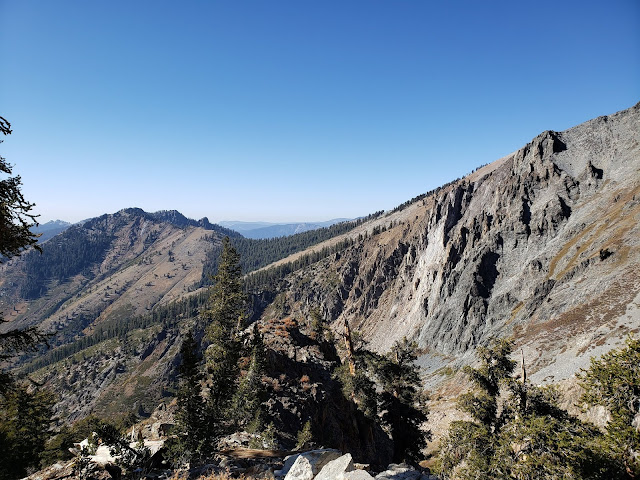
Looking back and up the Valley at the granite I'll be on top of later in the day...


It took me a little over 3 hours to reach the top of Black Rock Pass, which was ~18k in, with ~2/3rds of the climbing over with! This was my first stop for food, and to relax and enjoy the views.


From Black Rock Pass looking east. Little Five Lakes are to the left of the centre ridge, and one of the Big Five Lakes is visible on the right.


The trail around Little Five Lakes with the Kaweah's to the right


(lower) Big Five Lakes


I stopped at Big Five Lakes to eat lunch. At this point it was pretty much dead on noon, with 4:30 elapsed. I enjoyed the pizza I made on Thursday night, filled both my bottles and saw the only group between Timber Gap trail and Sawtooth Pass!


Small swampy lake


Breaking out into the sub-alpine in Lost Canyon


Meadows in upper Lost Canyon with Sawtooth in the background.


Lake Columbine and Sawtooth


The trail from Lake Columbine to Monarch Lakes is un-maintained. It wasn't hard to follow to Sawtooth Pass, but was no longer the super pleasant easy NPS trail.


Looking back from Sawtooth Pass


The un-maintained trail from Sawtooth Pass, As I mentioned earlier, was a steep sandy scree field. It was quite easy and fast to get down, but I ended the descent with shoes filled with sand. I would absolutely hate to climb this bit.


Empire Mountain from Sawtooth Pass


Scraggly trees past Monarch Lake... Back on NPS maintained trail


Looking towards Timber Gap


I finished the day in around 8:30 elapsed. I walked the last 3km of the descent down to Mineral King as I had ample daylight, and I did not feel like completely destroying my knees trying to run it. It was probably a good choice, and might have been why I could walk the next day??


Day 2:

I woke up with legs so I decided to do one of the hikes I hadn't previously done in Mineral King. With my sister 3 years ago we went to Franklin Pass (which is spectacular), and the previous day I'd done both Sawtooth and Timber... so it was off into the network of trails to the southwest of Mineral King. I more or less decided to follow whatever looked like the most used route since I hadn't looked into these before coming.


A gentle climb out of Mineral King


Following the most used trail, I ended up doing Eagle Lake...


A bench on the way up to Eagle lake


Looking back when almost at the lake


Eagle Lake


There was a boulder field on the trail, and this very neat rock was in the trail


Looking north-east at the peaks of Mineral King (from the boulder field)


Eagle sinkhole


There was a cool feature on this trail which I didn't notice on the way up... eagle creek disappears into a sinkhole on the bench. It then re-appears almost half a kilometre later!


Looking at Empire Mountain


Mineral King


Eagle Lake was a good little hike. It was about 11.5km with 650m of climbing. Probably one of the better short options out of Mineral King.

A great weekend in the sierra. Mineral King is a wonderful place!

Wednesday, October 9, 2019

Charlotte Dome 10/05/19 - 10/06/19

For the annual big backcountry climb where Caitlin drags Alistair up a rock face, we decided upon the south face of Charlotte Dome. The south face is a 12 pitch 5.8 route with ~450m of vertical.

The route:


The dome is a 16.5km, 1400m vertical hike from Roads End in Kings Canyon National park, most of which (13km) is along the pleasant Bubbs Creek Trail.

Looking up Paradise Valley while ascending into Bubbs Creek

Bubbs Creek
The not so pleasant bit starts when turning off the Bubbs Creek trail to ascend up the Charlotte Creek drainage. From here the trail gains 700m in 3.5km! We missed the proper start of the climbing trail, but found it within 10 minutes of walking and didn't have too much trouble following it the rest of the way up.

A little after the start of the climbing trail - looking east up Bubbs Creek valley

Climbing trail was a bit technical

Looking up at Charlotte Dome from the approach
We climbed past Charlotte Dome to get to the (perfect) camping location.The campsite was large, super flat, 30 seconds from a creek, and had a firepit ready to go!

Our wonderful campsite to the north of Charlotte Dome.
We went to bed super early (thanks october!) and were up again at 530 to get ready for the climb. We left the campsite around 620 and were at the base of the climb at 7.

Early morning light on Brewer, North Guard and Farquhar

Charlotte Dome in the morning light
We started up the climb at 715, and just as we were about to head up, the second and only other party that day, showed up. We had finished our first pitch when they started their day up the climb. We were more or less the same pace as them throughout the day.

Views east from partway up the climb

Looking down at the other party on the climb that day
There was a decent bit of route-finding on the way up, as there are many places where you can really go your own way. We mostly stuck to the book, but ended up extending our climb up the furrows, and adding a pitch somewhere along the way (13 total for us).

Panorama from the summit

Caitlin happy to be be at the top of Charlotte Dome
We summited around 430 and were back at our campsite a little before 6... unfortunately that meant we were more or less descending in the dark after the time it took to tear apart and pack up our camp.

Light was fading fast as we were tearing down camp
We had a little bit of light at the start of the descent from camp, and during that time managed to avoid the bushes and stick mostly to the cairned trail. There was a point at which we were supposed to traverse across a rock face, and we did not, and we subsequently spent 30 mins stumbling over manzanita and spikey bushes trying to get back onto the trail at a lower point. It was not fun at all... but we eventually made it back onto the trail and didn't have too many issues from that point on. It was a huge relief to hit Bubbs Creek trail, and honestly felt like the night was over, as it was all cruisey downhill from there. My headlamp died right as we got to the south fork of the kings river, but at that point we were only 3 miserable sandy kilometers away from the car. We made it out at 1130, and stayed the night in sentinel rather than trying to make it home. Was late for work the next day but...?

Thursday, October 3, 2019

Whistler Trip 09/07/19 - 09/22/19

I don't have any specific routes to show, but I thought I would share some pictures taken on my two week escape from California.

BC forest!

Hometown trails

Granite ribbon

Nico on some steeps

Wonderful climbing

Nico using all of his bike

Sproatt Alpine on a cloudy day

Raspberries were in season!!!

Pond on whistler

Cheakamus forest

Loggers lake

Wet at Garibaldi Lake

Superb colours

White slug!

Looking towards rainbow on a nice day

Towards Sproatt

Colin dropping in

Me dropping in

Colin over whistler valley

Bikes on Sproatt

A++ trails

Westside trails

More Westside

Me on out there wallride

Colin on out there

Colin climbing Nimby

Top of Mackenzie Cruise in Pemberton


Cheakamus trails


Business Time
Squamish


Steep Slabs

Looking out over Howe Sound

Colin and moss

Me goofing around on a granite feature

Very cool trails

Mega slab!


Classic Squamish

Coolest fungus ever!

Gouranga

Is steep!

Cruising along to the next steep slab

Dropping in over pemby

Copkiller trail


Whistler bike park loamer

Descending down into the Creekside trails